Took off for our first (mini) trek!! We decided that we wanted to and were capable of doing Annapurna sans guide and sans porter, so we tested the waters by venturing out on our own for 2 nights/3 days from Sundarijal to Dhulikhel. Naturally, we (… I…) lost our map within the first 20 minutes (and my Gryffindor hat later in the afternoon… RIP hat), but, shockingly, we made it out alive and successfully!! We think (read: hope) we can tackle Annapurna next!
Miles walked: 46
Miles transported: ~35
Oct 26: Sundarijal to Chisapani
The first leg of our trek. We didn’t do much research aside from how to get to Sundarijal, so we had no idea what to expect. Lo and behold, we had a good 3.5 hours of straight ascent to look forward to. But it was well worth it! The hike and Chisapani were both amazing! See stats and photos below.
Hike stats:
Distance: 12.5 miles (20 km)
Time: 4.5 hours
Start elevation (Sundarijal): ~1,350m (~4,450ft)
End elevation (Chisapani): ~2,200m (~7,200ft)
Max elevation reached: ~2,300 (~7,550ft), though our GPS shows max elevation reached was 7,738ft.
On the bus, waiting to take off for Sundarijal, looking at pink cotton candy bobbing up and down outside the window:

Arrived at Shivapuri Nagarjun National Park:
We’ve only just begun the ascent and I’m already exhausted (note – map and hat still accounted for):

Francy still standing strong:


I made some friends (not that they seem too happy about it):

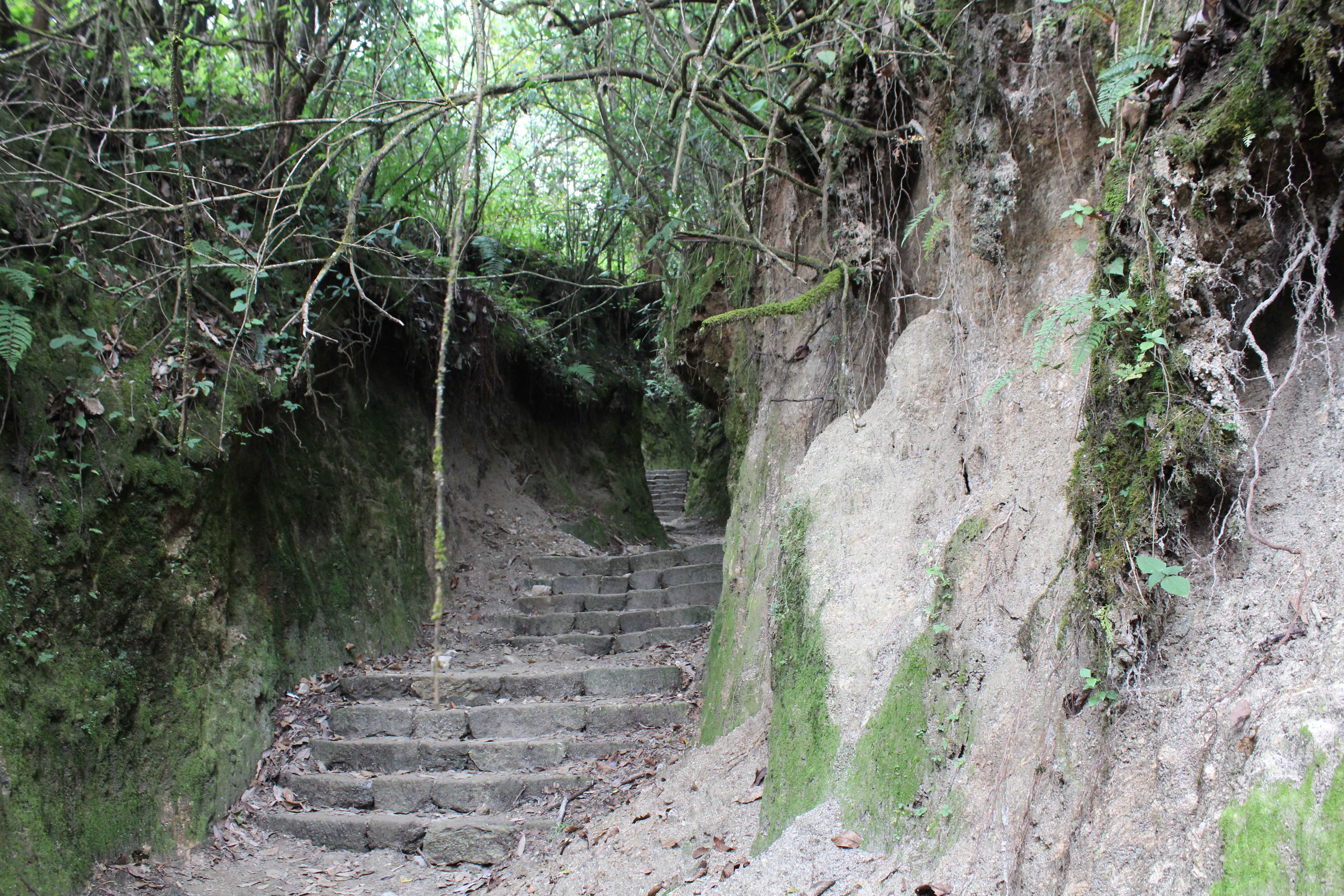
SO MANY STAIRS:

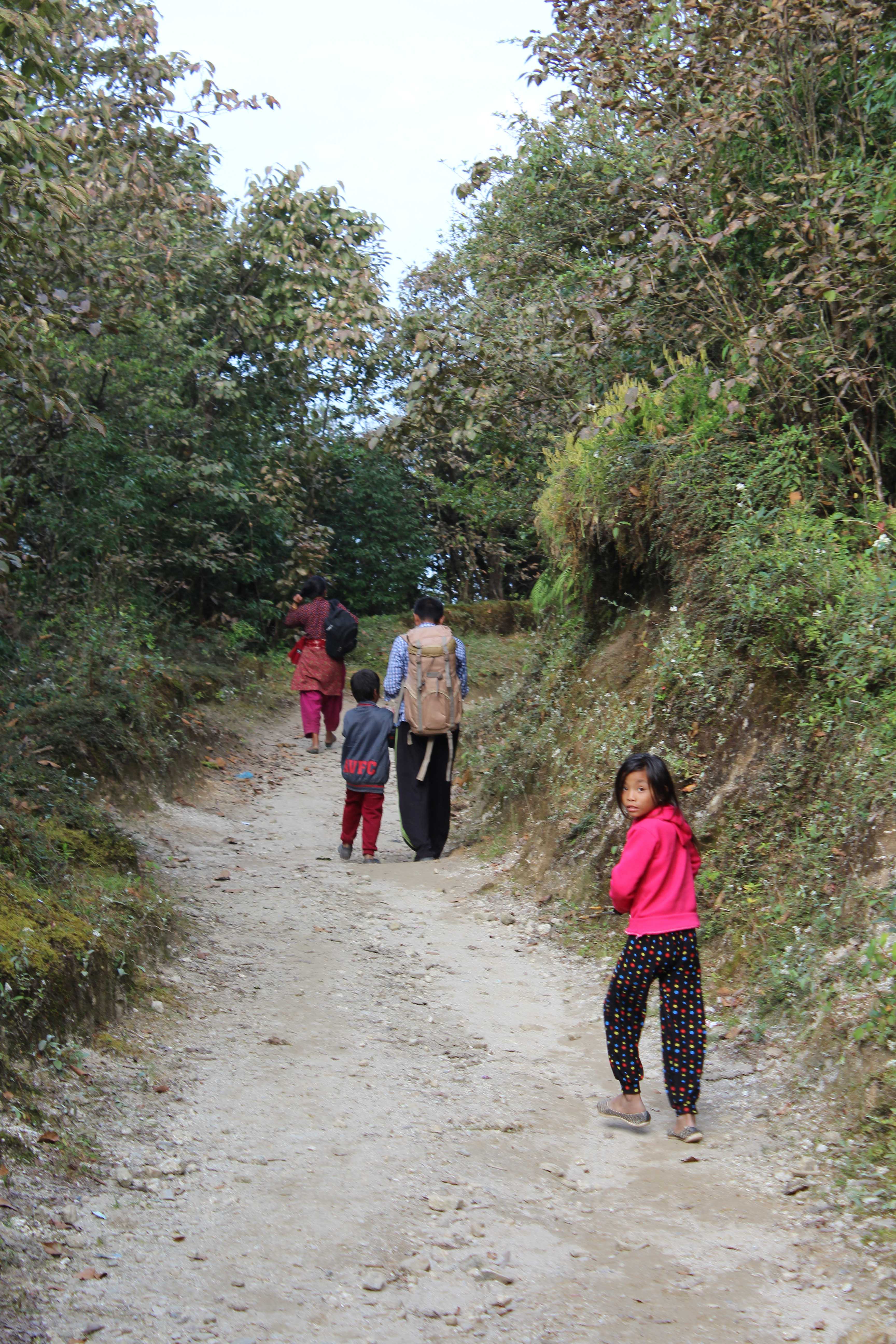
Caught up with this family for the last 20 minutes to Chisapani. The little girl was carrying a live chicken for the entire journey, though she kept hiding it every time we tried to take a picture! How rude.
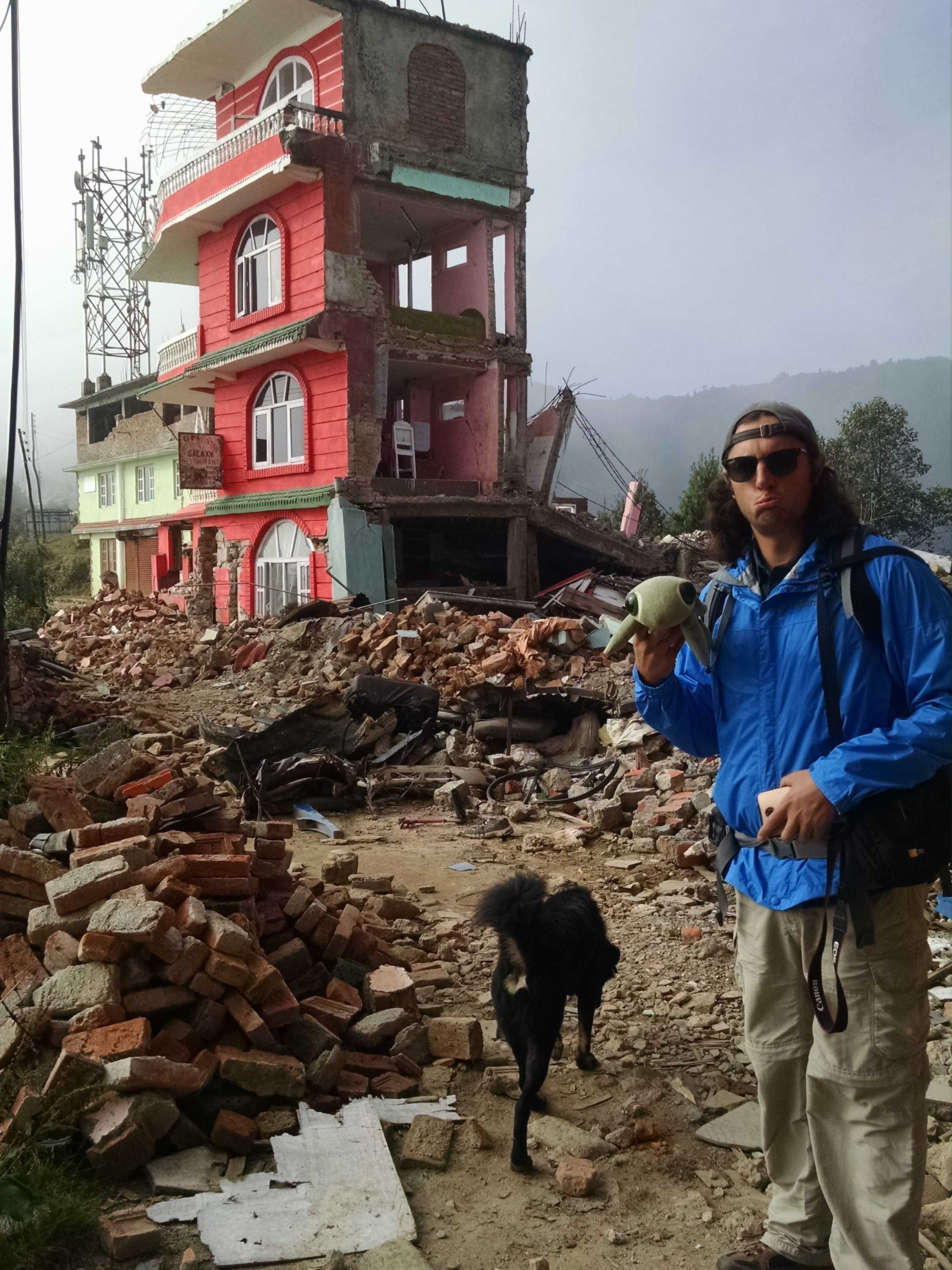
At last, we arrived in Chisapani. We ran into a guide on the way up who recommended we stay in Hotel Annapurna. Well…


Tragically, 90% of Chisapani was destroyed in the earthquake. We spoke to the man that owns the guest house you see standing before you (or rather, what remains of it). He was on the top floor of the only part that stayed up when the earthquake hit. Fortunately, he was able to get most people out alive, but 3 locals and 3 tourists died. My little brother, Nadav, was staying in that guest house the day before the quake hit…


Oct 27: Chisapani to Nagarkot
Second leg of our trek. See stats and photos below!
Hike stats:
Distance: 18 miles (29 km)
Time: ~7 hours
– Note: This hike is SUPPOSED to be 18km (as you can see in the picture) and take around 5.5 hours, but as we were trekking solo and we (ahem, I…) lost our map within the first 20 minutes of our trek, we may have taken a slight detour… also, we spent quite a while hanging out in a very special spot we found (see pics below).
Start elevation (Chisapani): ~2,200m (~7,200ft)
End elevation (Nagarok): ~1,900m (~6,250ft)
Max elevation reached (at Chisapani): ~2,200m (~7,200ft)
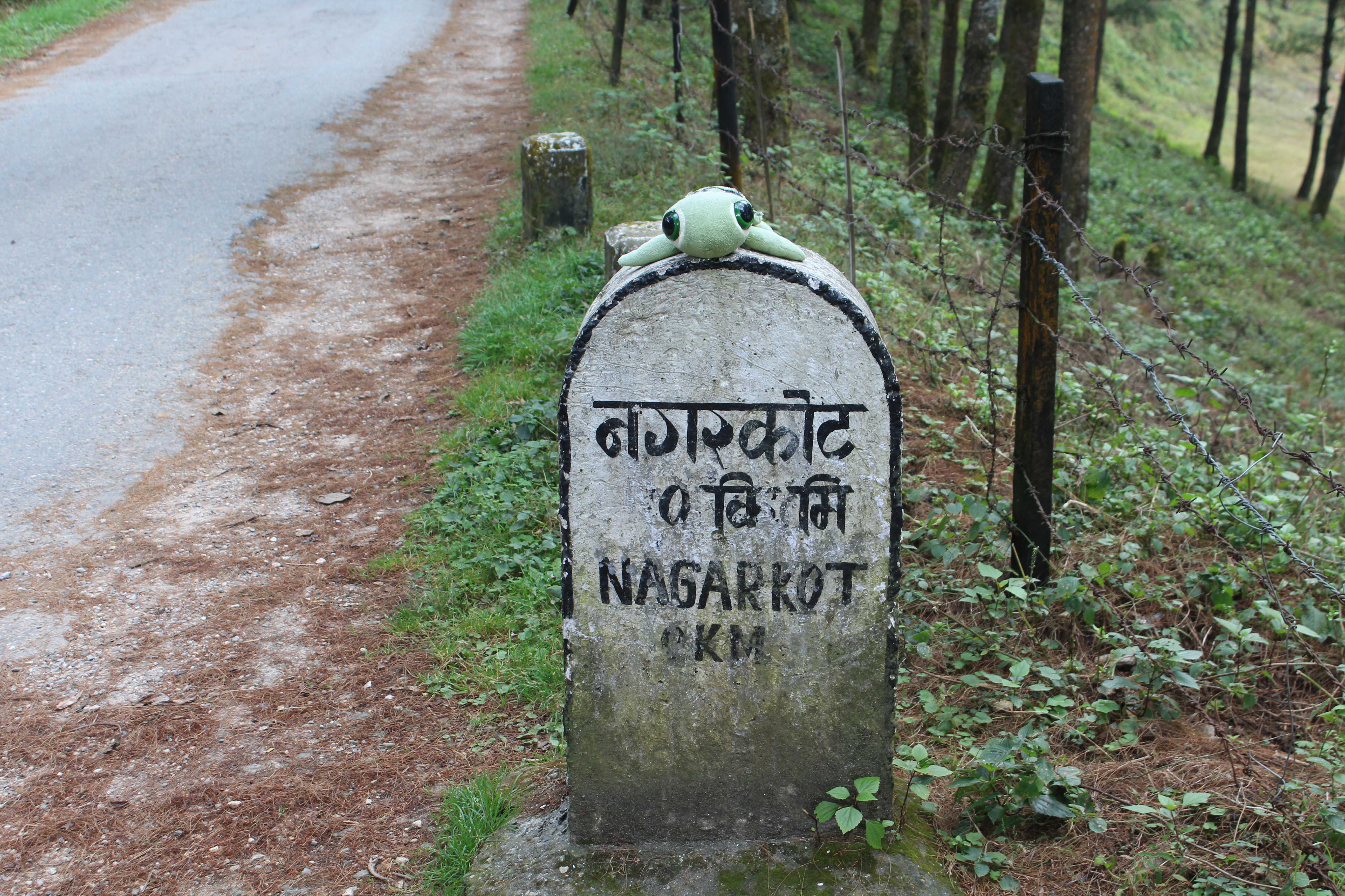
Off to Nagarkot! Good thing we have great signage, since we lost our map and all…

I mean, like, really really lucky there was good signage:


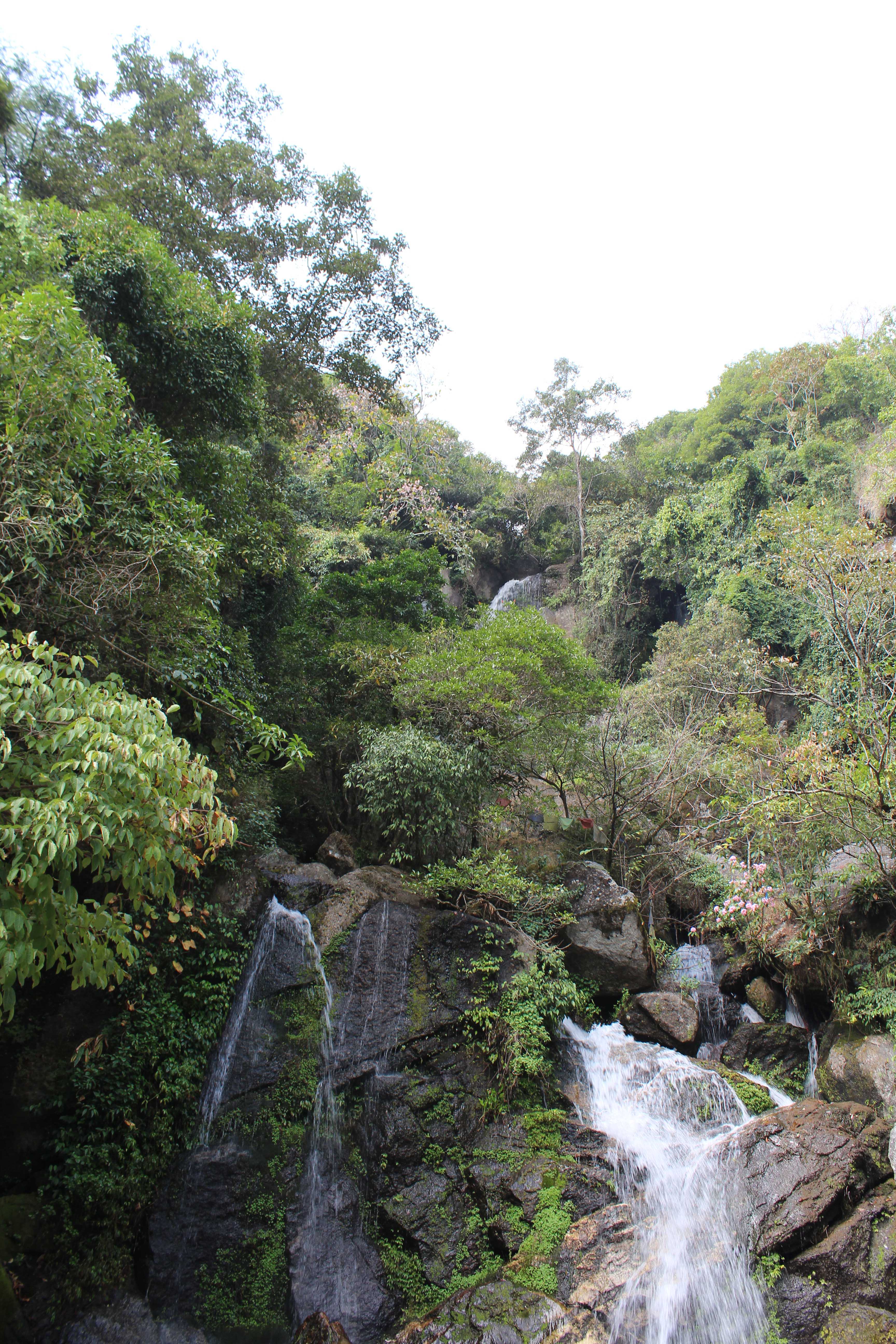
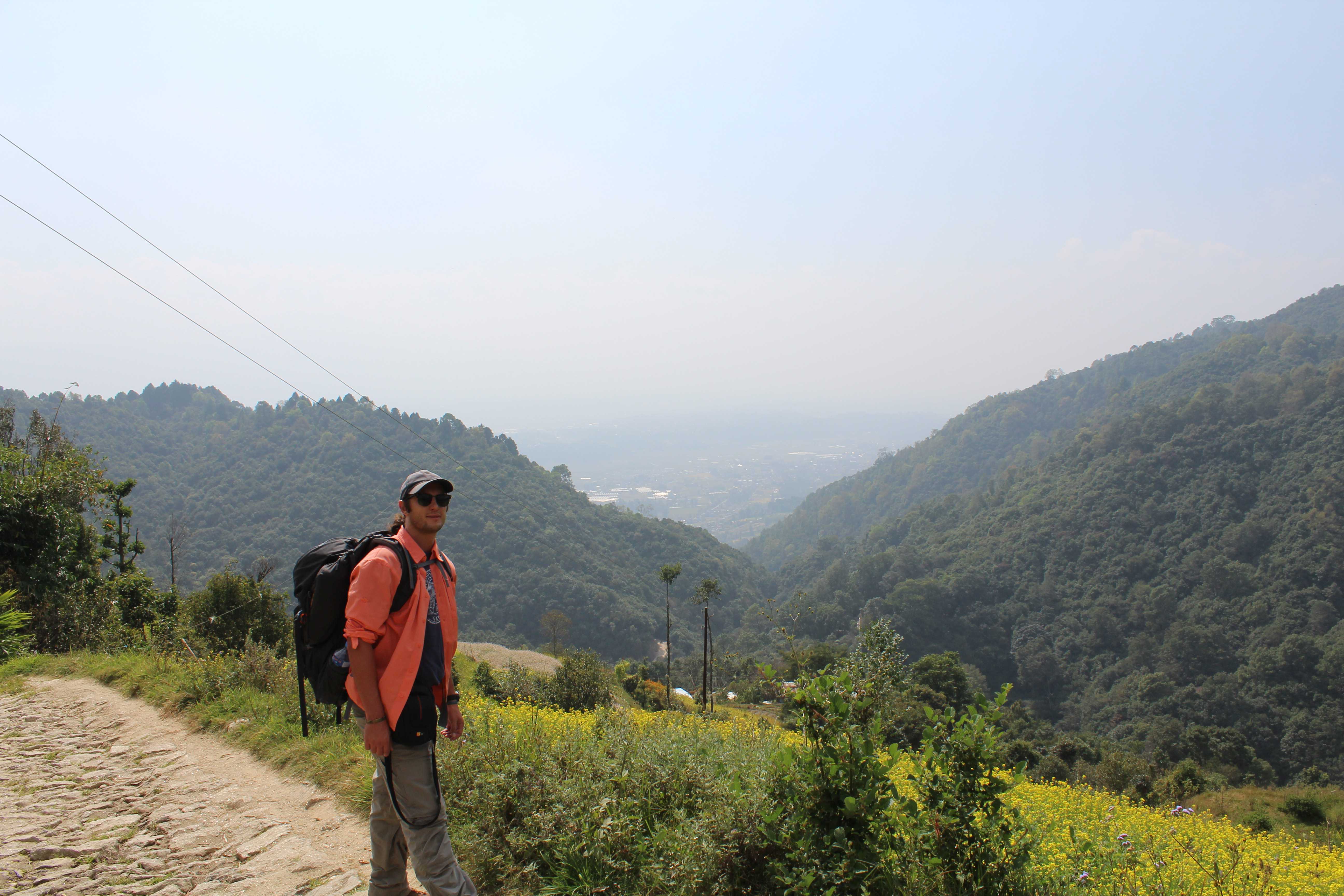
Francy found a little turnoff midway through the hike with a bench, where we decided to take a little break and enjoy the view. We were 7,000ft in the air, practically up there with the clouds!

All of a sudden, we noticed a little something peeking out from behind the clouds…
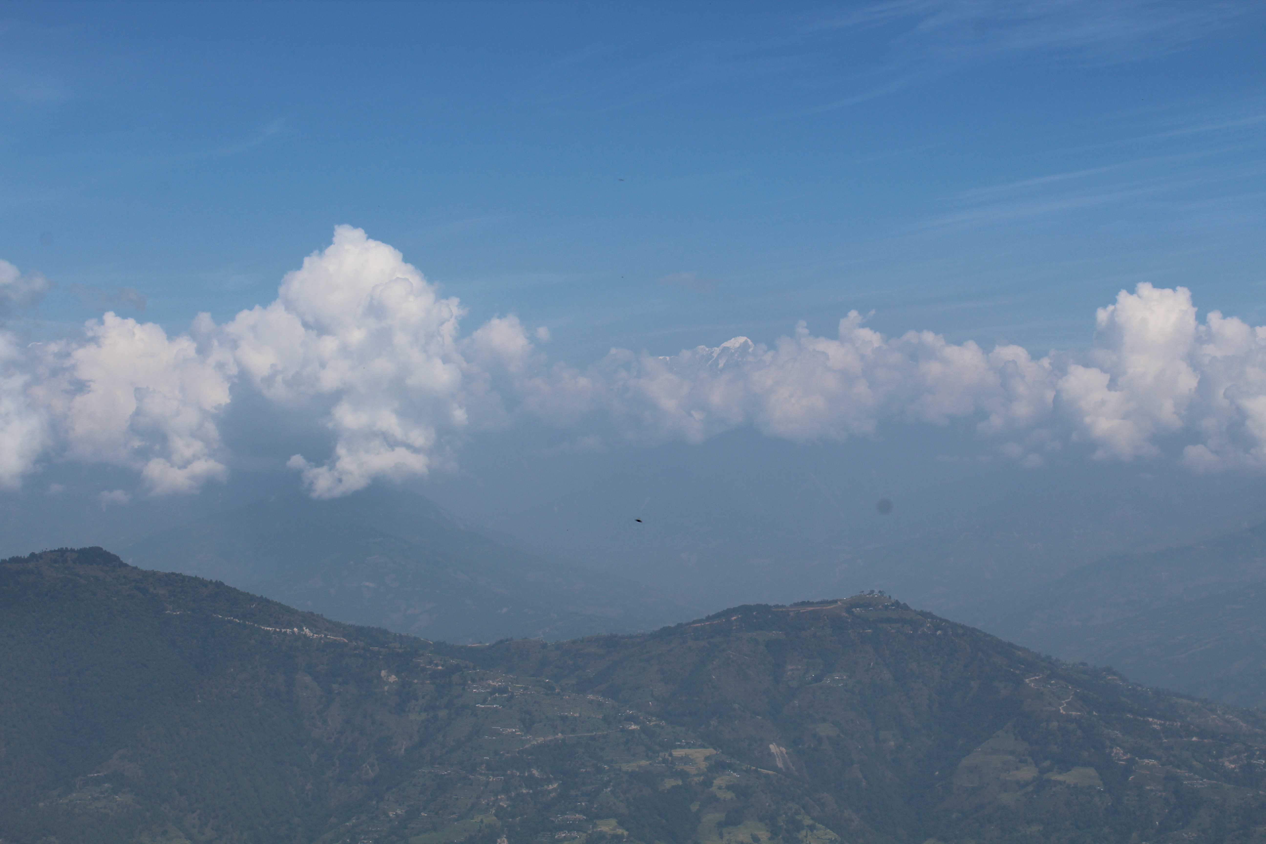
Could that be…???
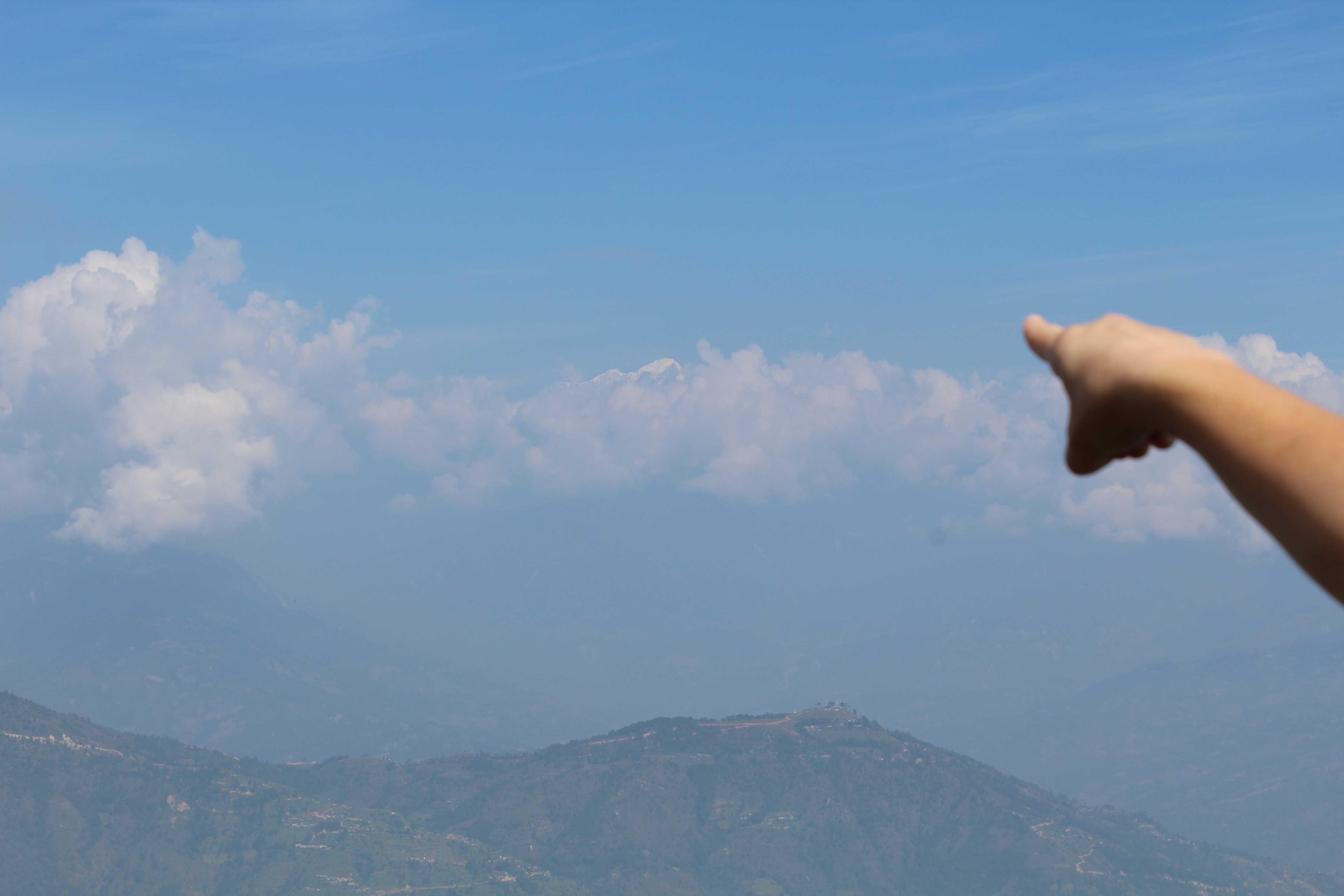
Samsonite… I think you’re right… That IS Mount Everest!!

And just in case you don’t believe us, we took a raw (20 MB!) photo, since our camera’s zoom isn’t that great, and blew it up, just so we could prove it to all you non-believers:

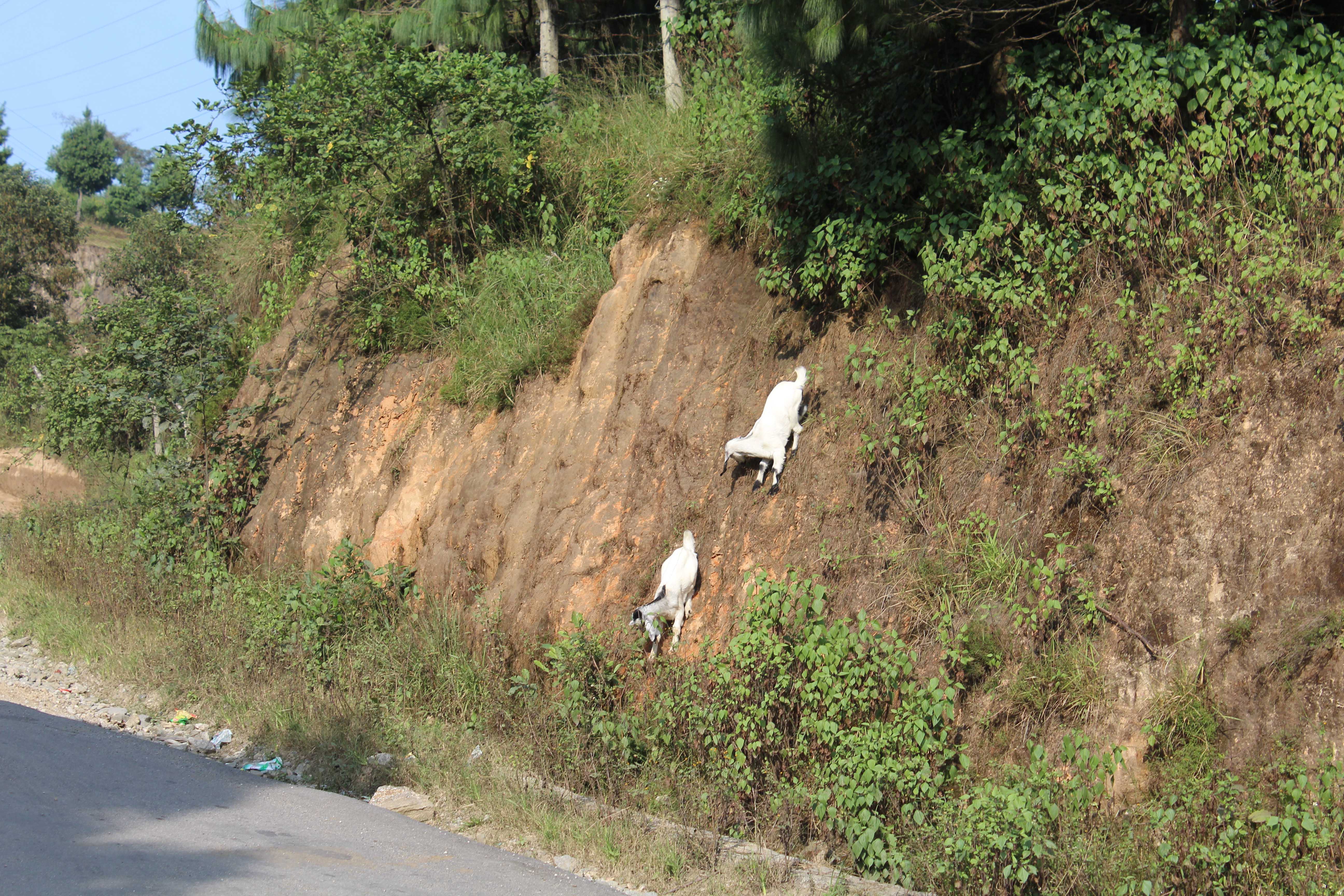
After spending about 45 minutes gaping at a mountain, we decided to continue on. Found these badass goats:
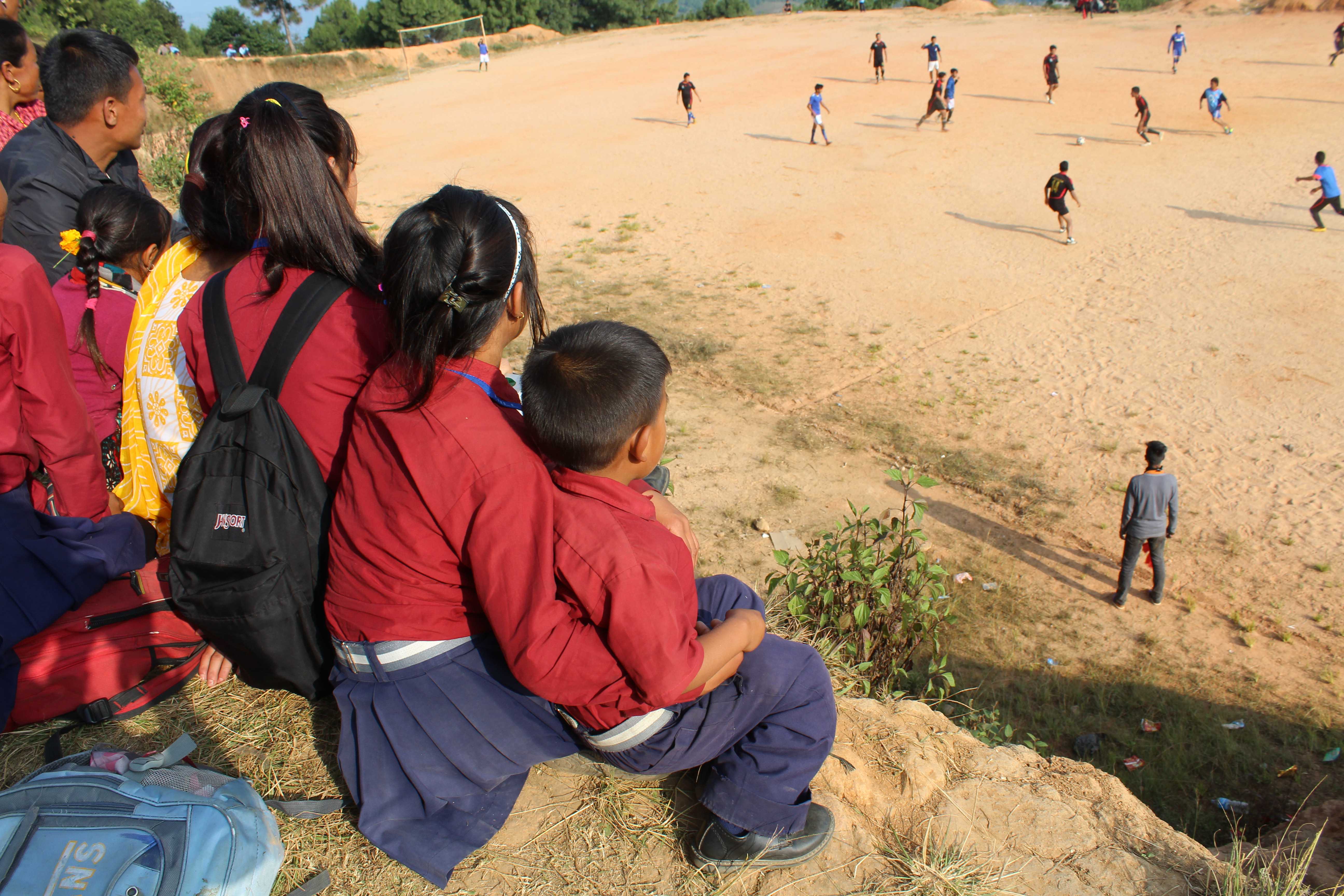
And stumbled across a soccer game, which we sat and watched for a while:
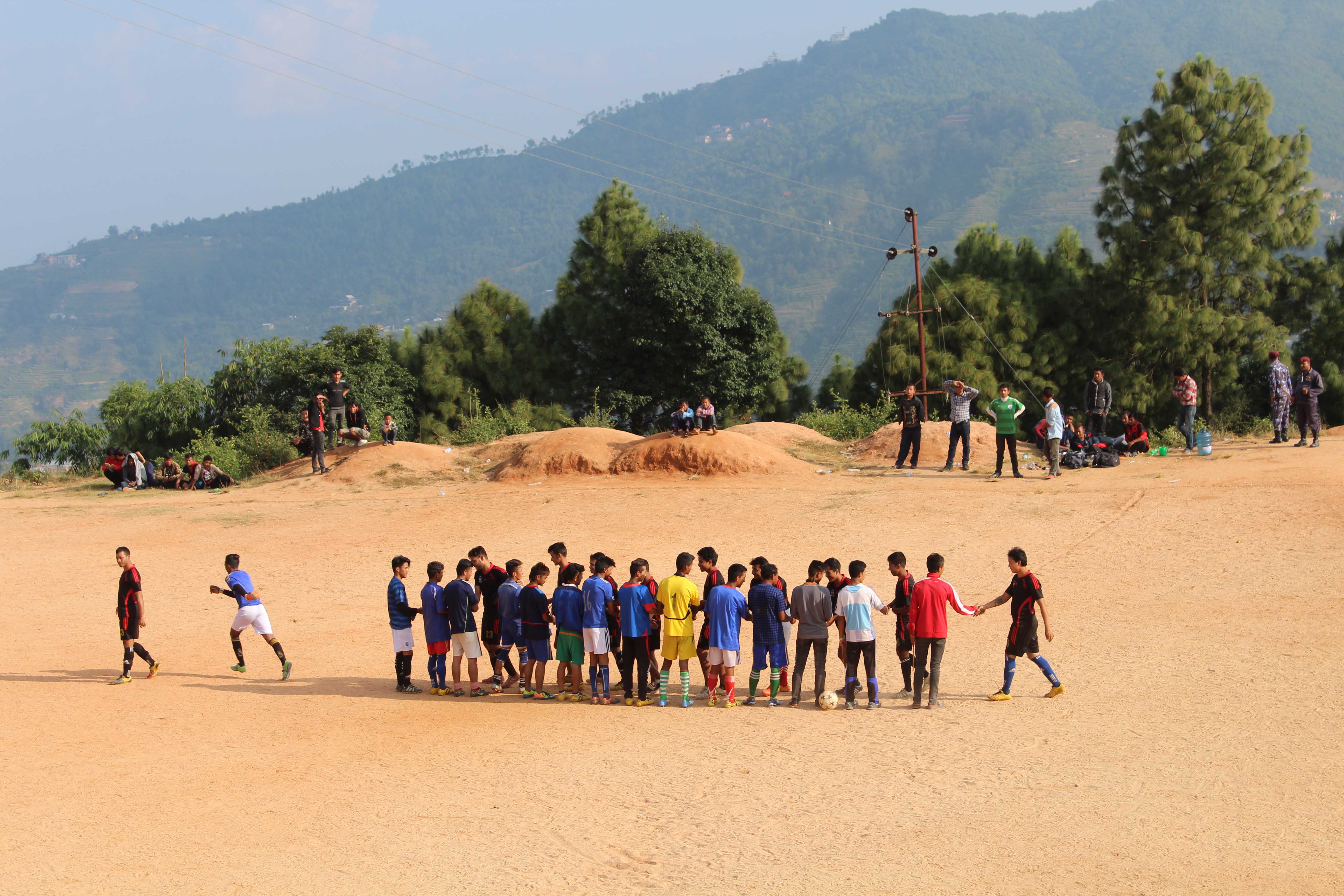
Not a bad backdrop for a soccer game:
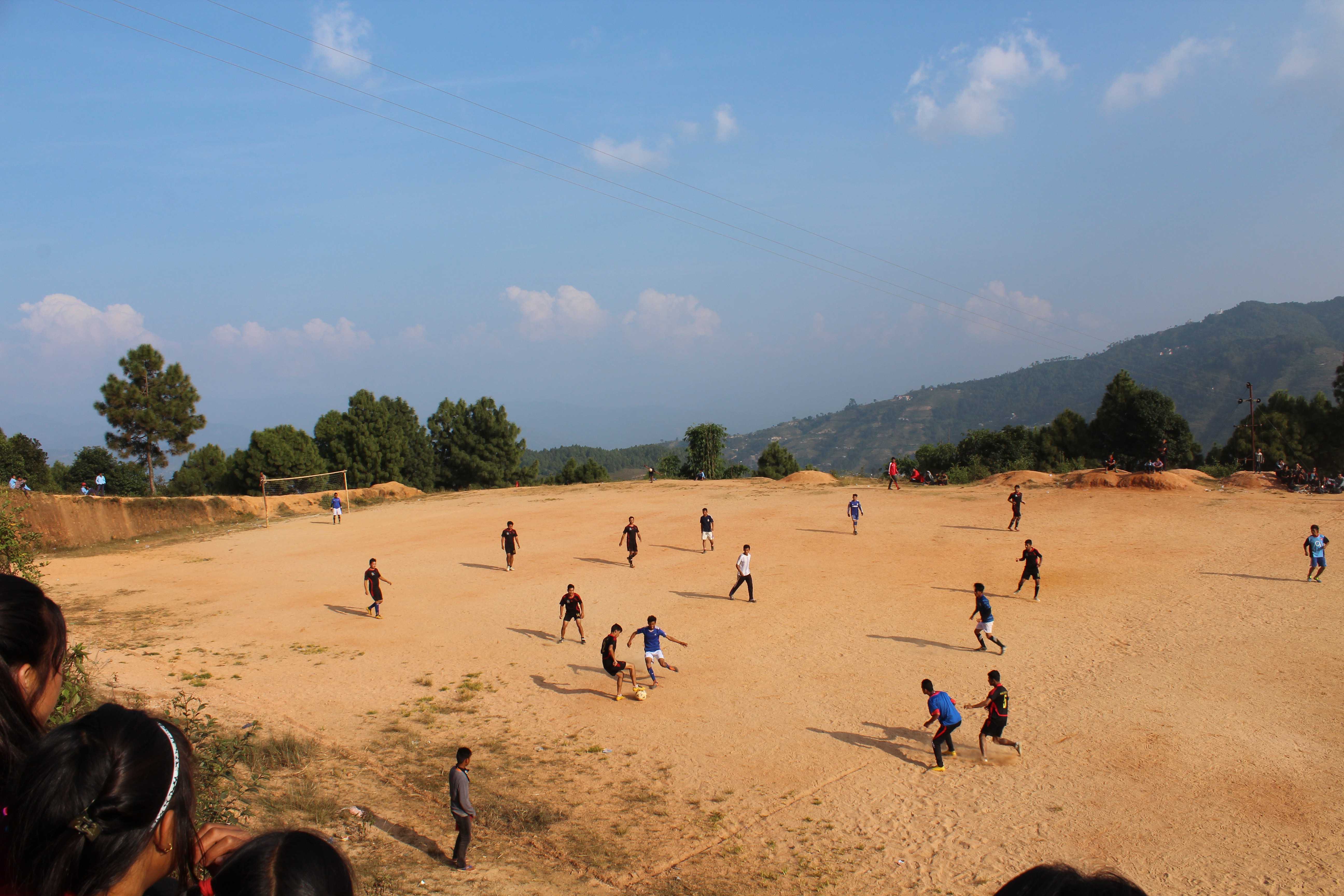
Premium stadium seating:


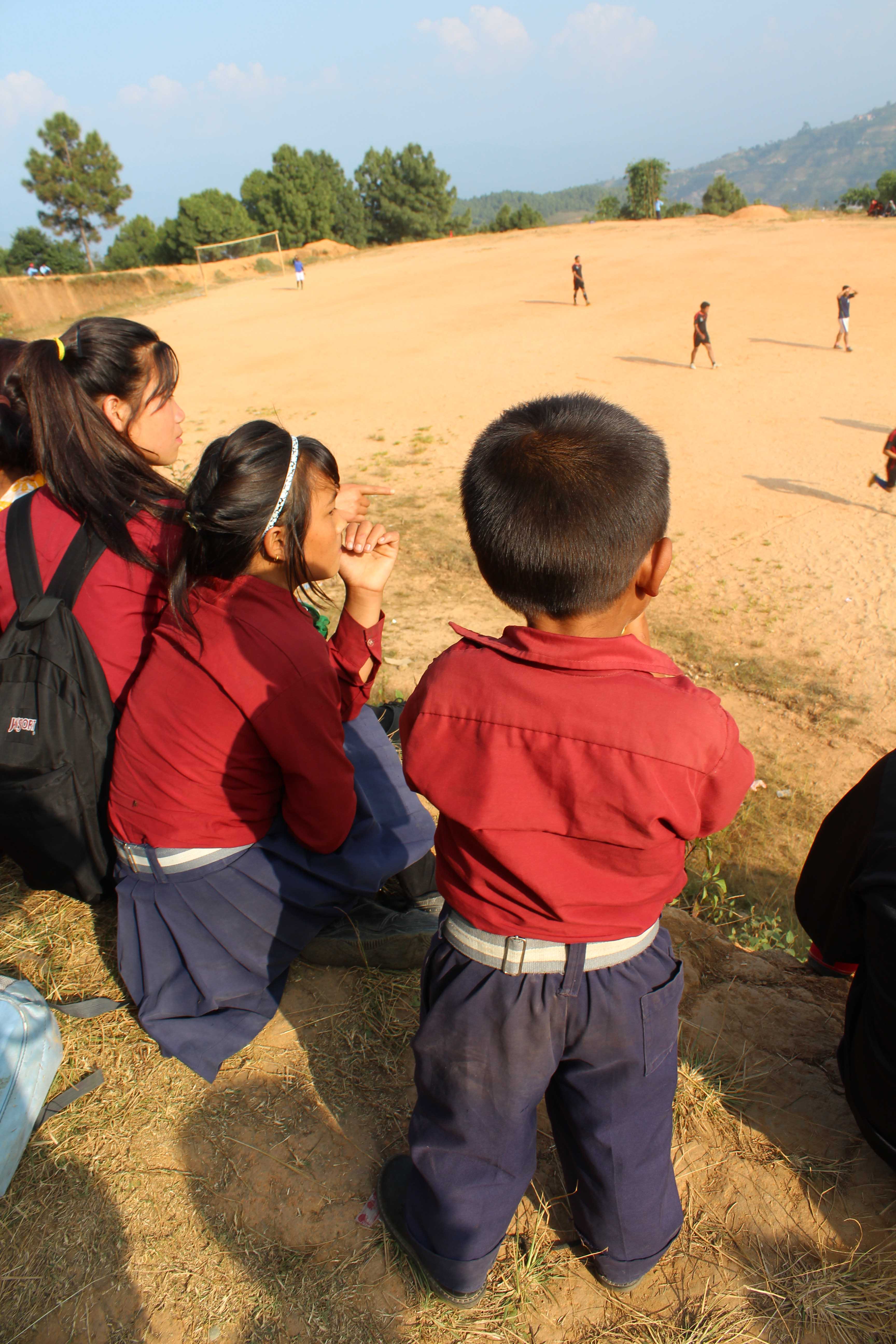
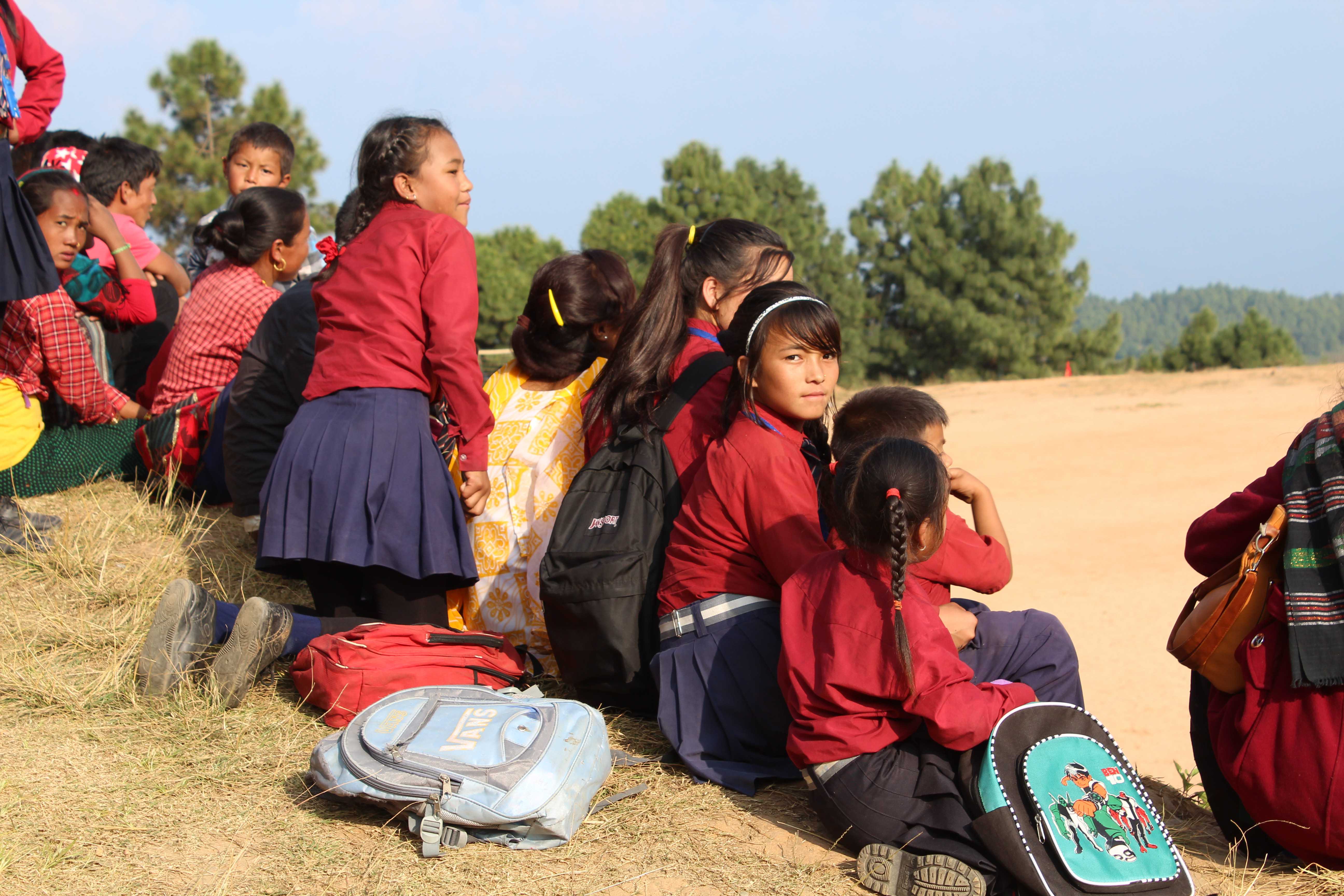
And these adorable children in their school uniforms:
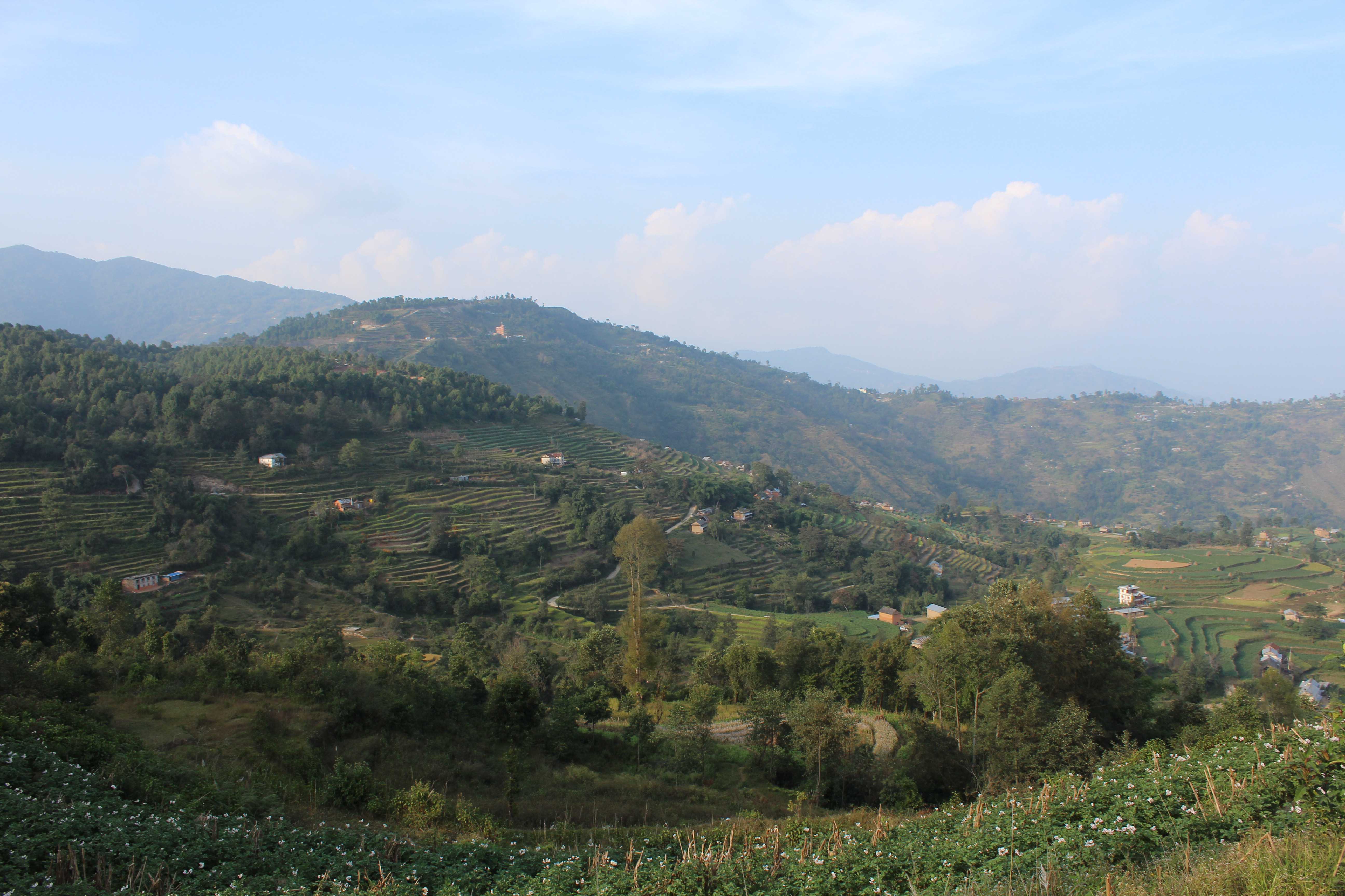
Incredible views:
Goats, chickens and Francy:


Finally made it (map-less, no less) to Nagarkot!
Too bad this place was closed… ammiright?

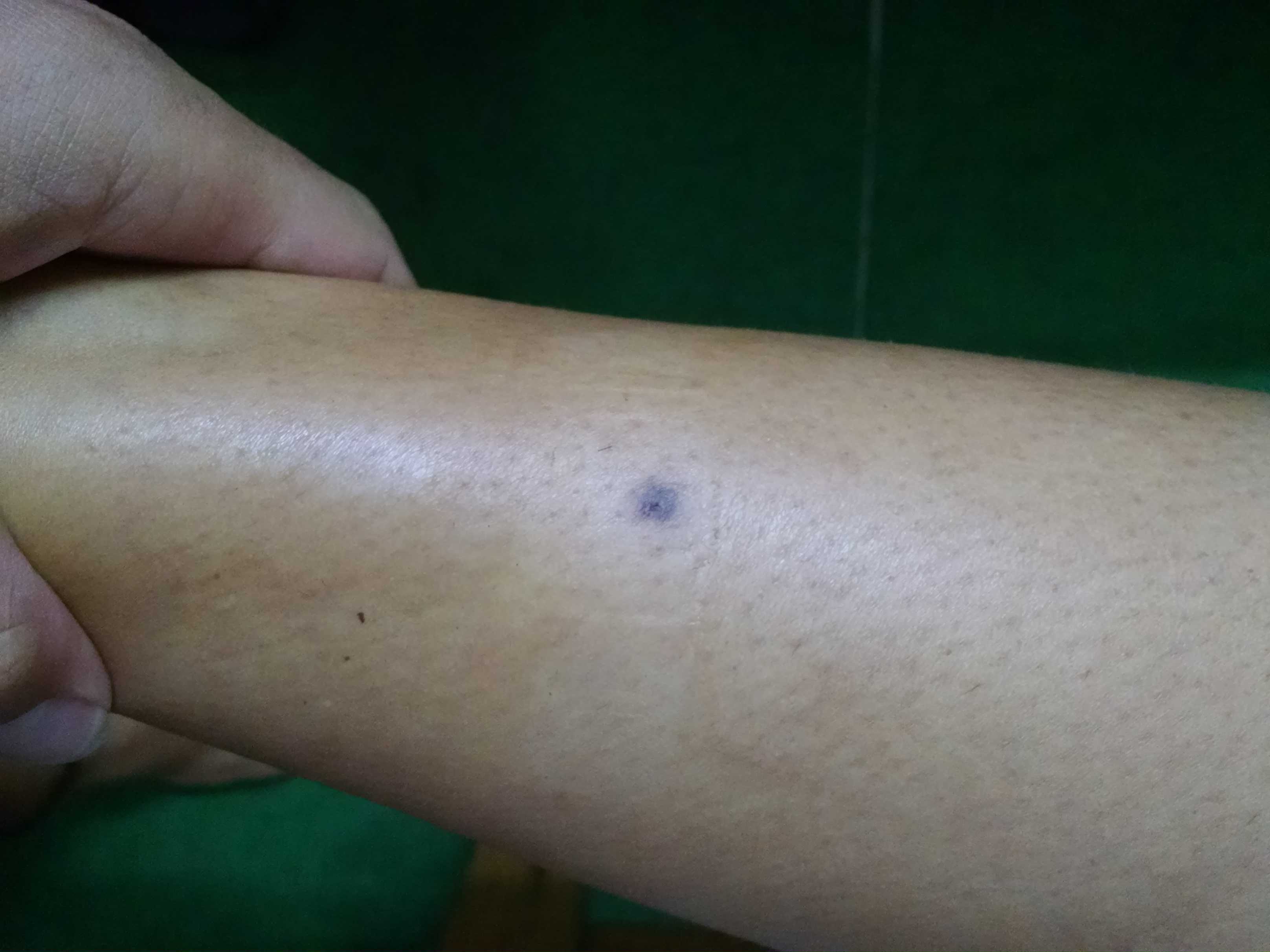
Arrived to find my pants full of blood and this little remnant on my leg… apparently, somewhere along the way (probably when we immobilely sat staring at Everest for 45 minutes), a passenger, in the form of a leech, joined my leg for part of the journey. I didn’t feel a thing! Sneaky bastard…
Oct 28: Nagarkot to Dhulikhel
Third and final leg! Then took the bus from Dhulikhel back to Kathmandu, which was an adventure in itself. Check out stats and photos.
Hike stats:
Distance: 15.5 miles (25 km)
Time: 7 hours
Start elevation (Sundarijal): ~1,900m (~6,250ft)
End elevation (Chisapani): ~1,550 (~5,100ft)
Max elevation reached: ~2,170 (~7,100ft)
This adorable little girl (Leya) was running the show at our guest house:

And off to Dhulikhel. Great news… we found a map! Well, part of a map. And not exactly the part we needed either…
Still in the clouds:
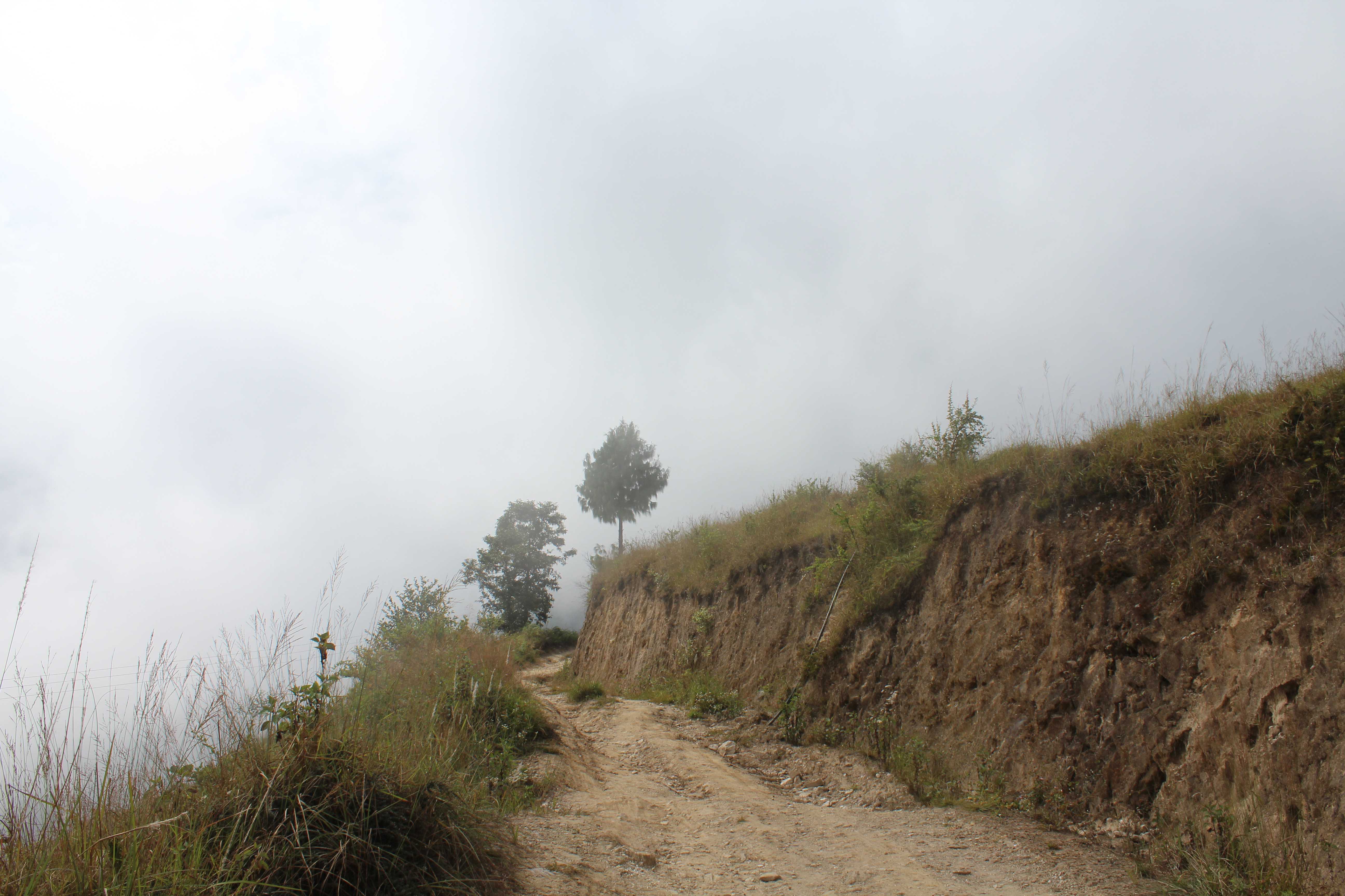
About 4 hours into our hike, the amazing signage we had been relying on throughout this trek finally failed us and we got lost. We ran into a family heading in the direction we just came from, who managed to communicate to us that we had been heading in the opposite direction for the past hour (all downhill…) and that we should turn around and follow them. So, we did:

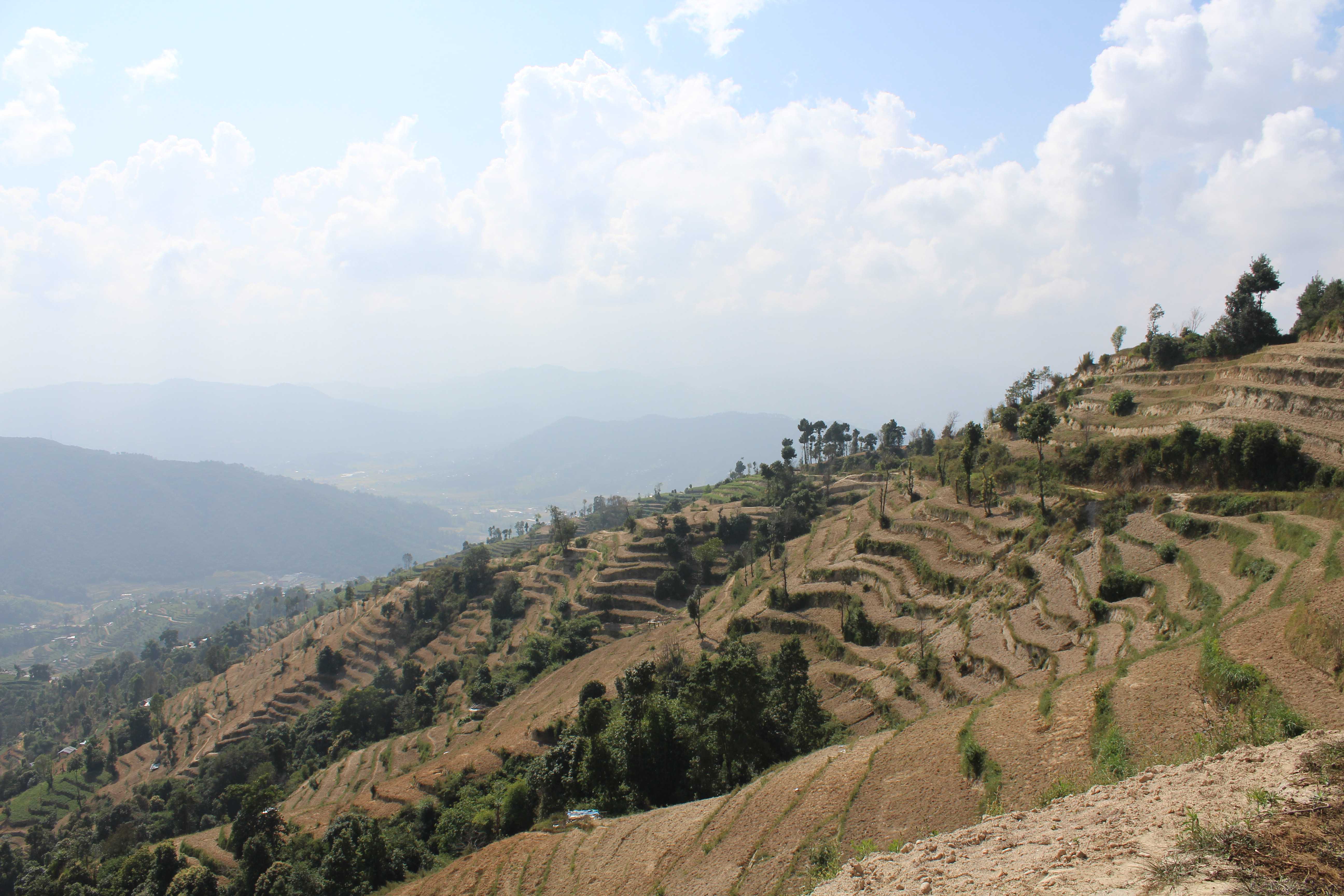
Along the way, we picked up another trekker and his guide, who were lost as well! Together, the 7 of us ventured through the mountains (well, mountains to us simple folk. These are too small to be called mountains in Nepal… they are mere 7,000ft tall HILLS…) in search of Dhulikhel. Saw some more incredible views along the way:


Finally, after 7 hours of hiking/wandering/meandering/following, we made it to Dhulikhel. Unbeknownst to us, more adventures were yet to come.
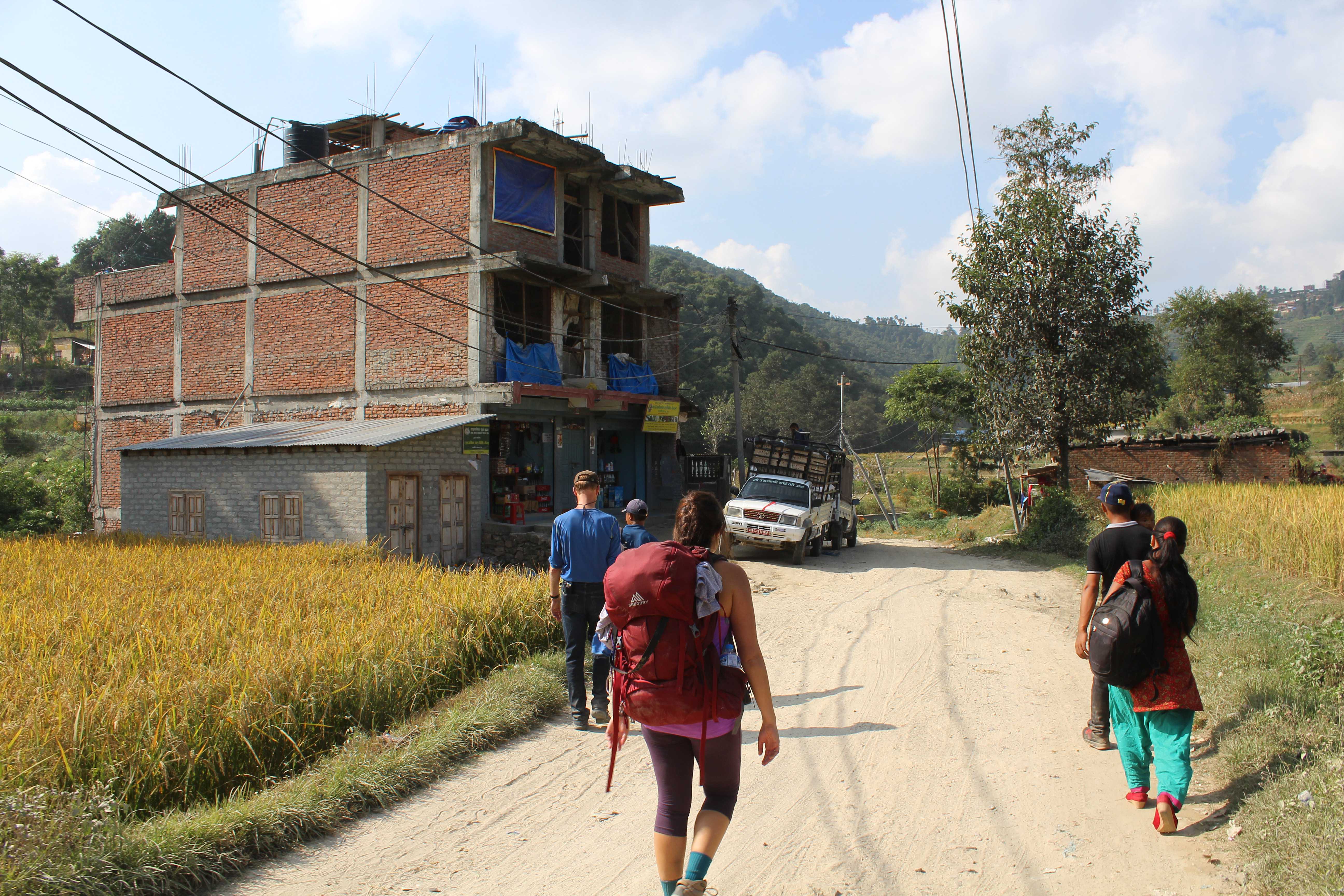
Oct 28: Back to Kathmandu
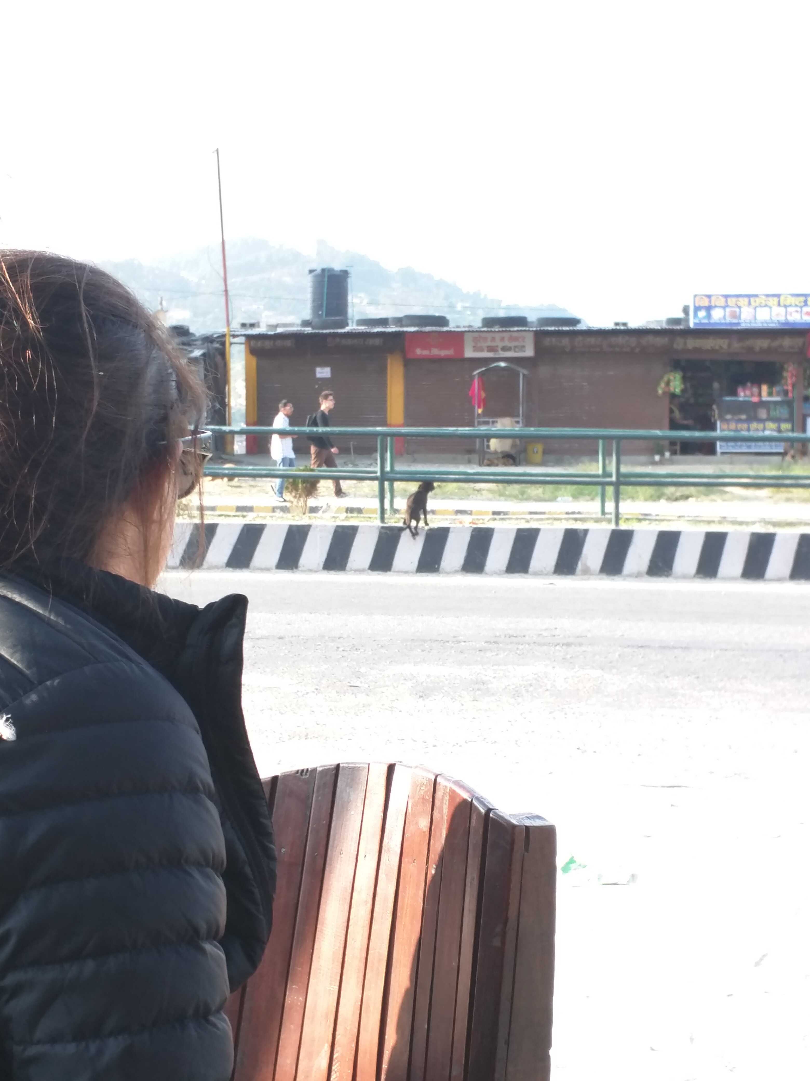
Originally, we wanted to take a bus from Dhulikhel to Namo Buddha. We waited 1.5 hours for a bus that never ended up arriving (because of the fuel crisis). Saw some cool stuff while we waited though, like this adorable puppy trying to hop the barrier:
And this stubborn goat (pet or dinner?) on a leash:

And people selling snacks to people on bus roofs:
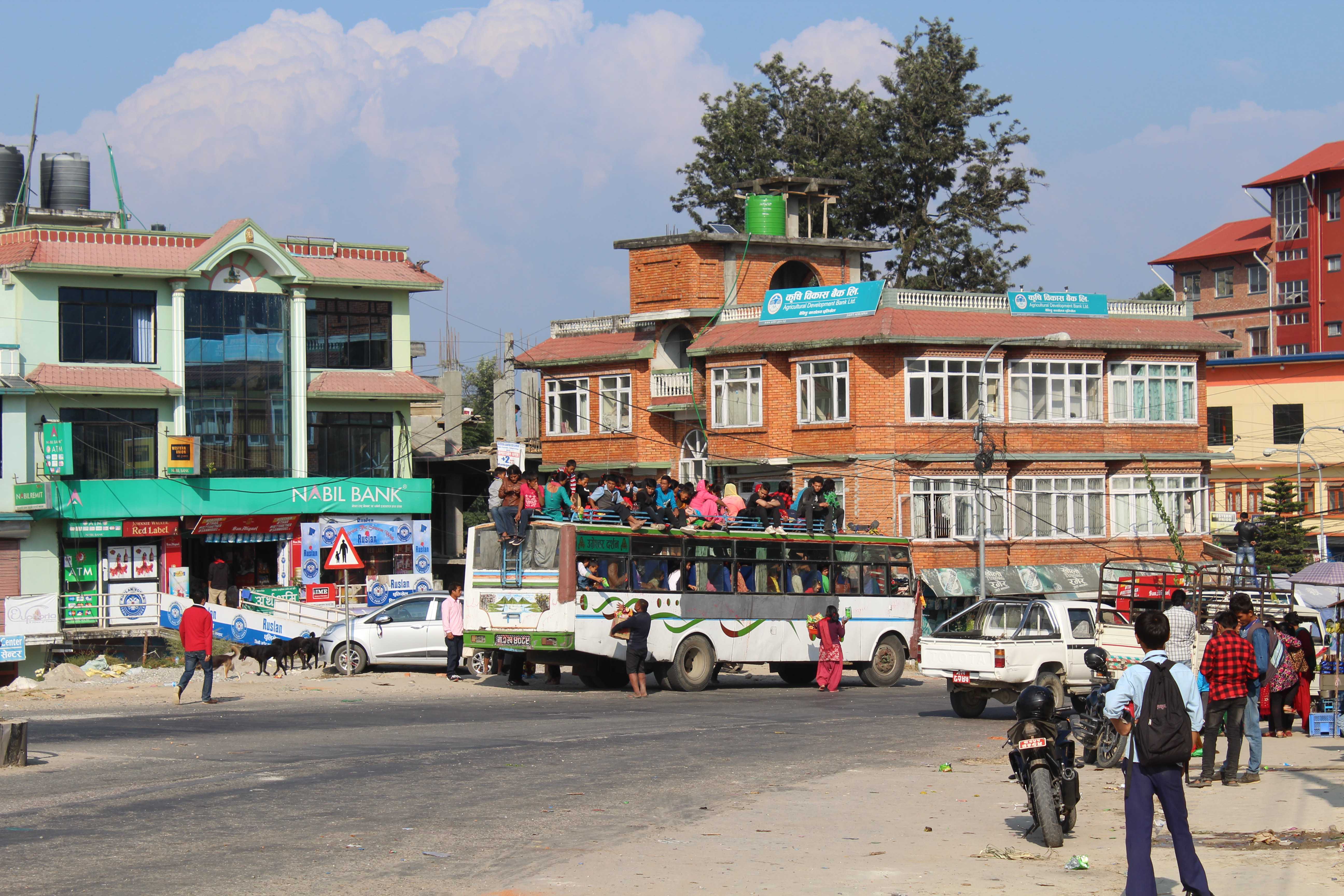
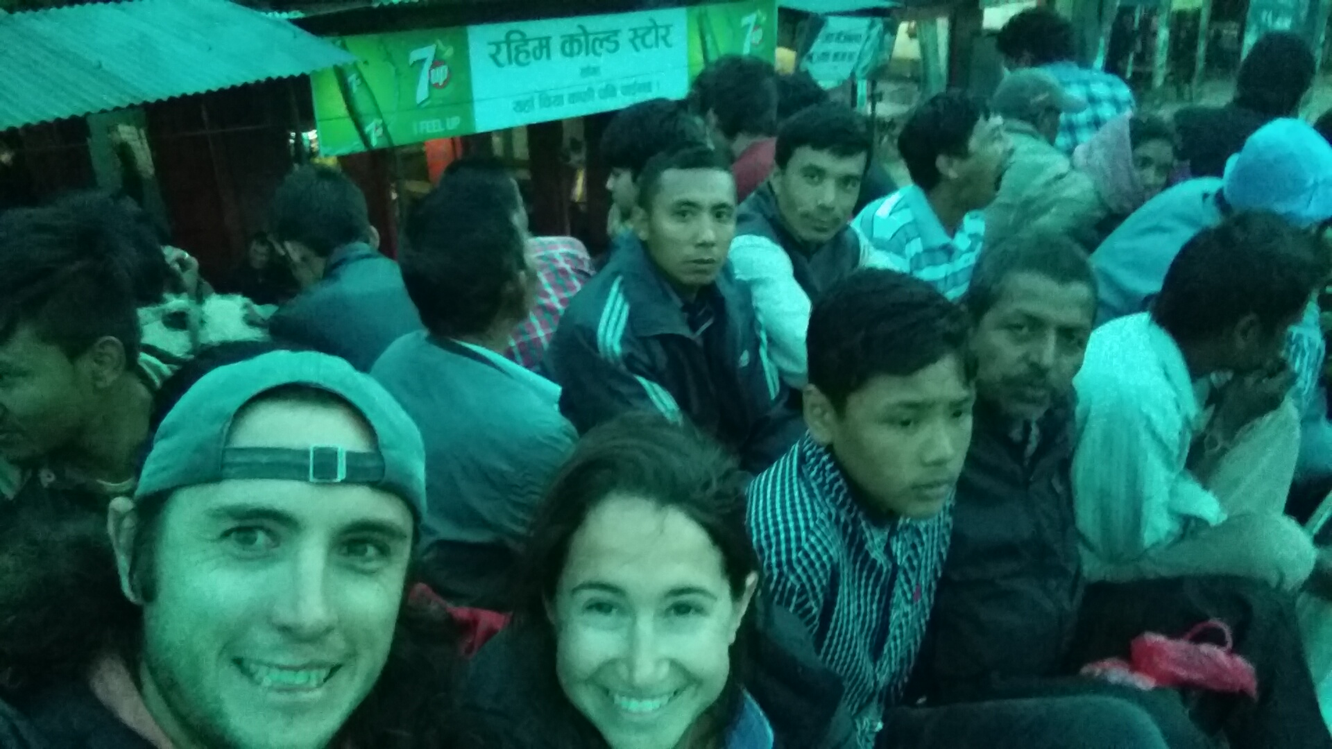
Realizing we weren’t getting to Namo Buddha that day and not wanting to spend the night in Dhulikhel, we gave up on Namo Buddha and ended up heading back to Kathmandu… on the roof of a bus… for 2.5 hours…

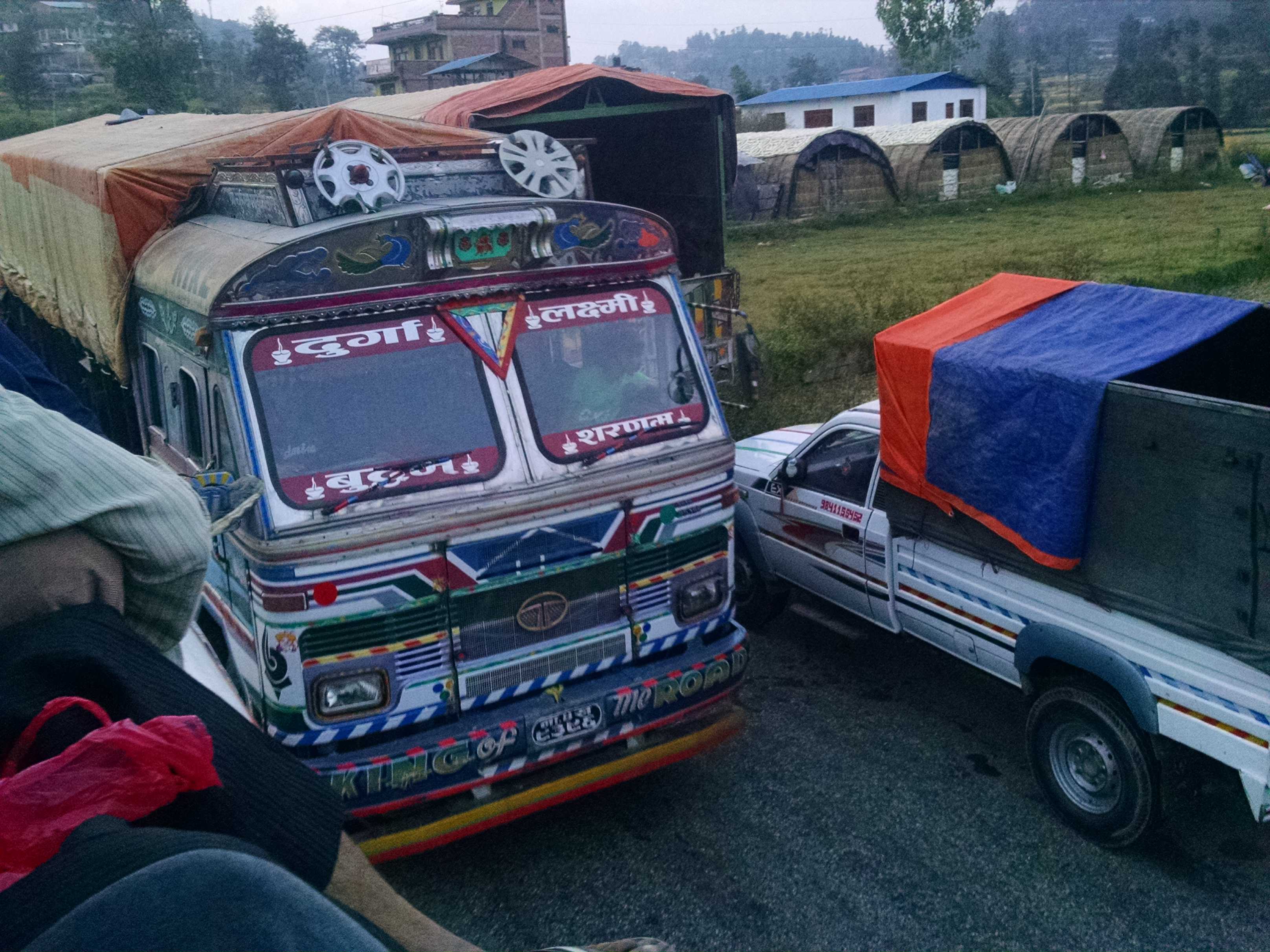
A dude climbing around on the rooftops of parked cars, trucks and buses, all waiting in line for the gas station to open up the next day and sell the limited amount of fuel that it has (if you’re not up to date about the Nepali fuel crisis… read about it now. It’s devastating to this country, especially during such a critical time as they are trying to rebuild all the damage from the earthquake):

Cows, hanging out in the middle of the road:

Amazing how the buses fit through…
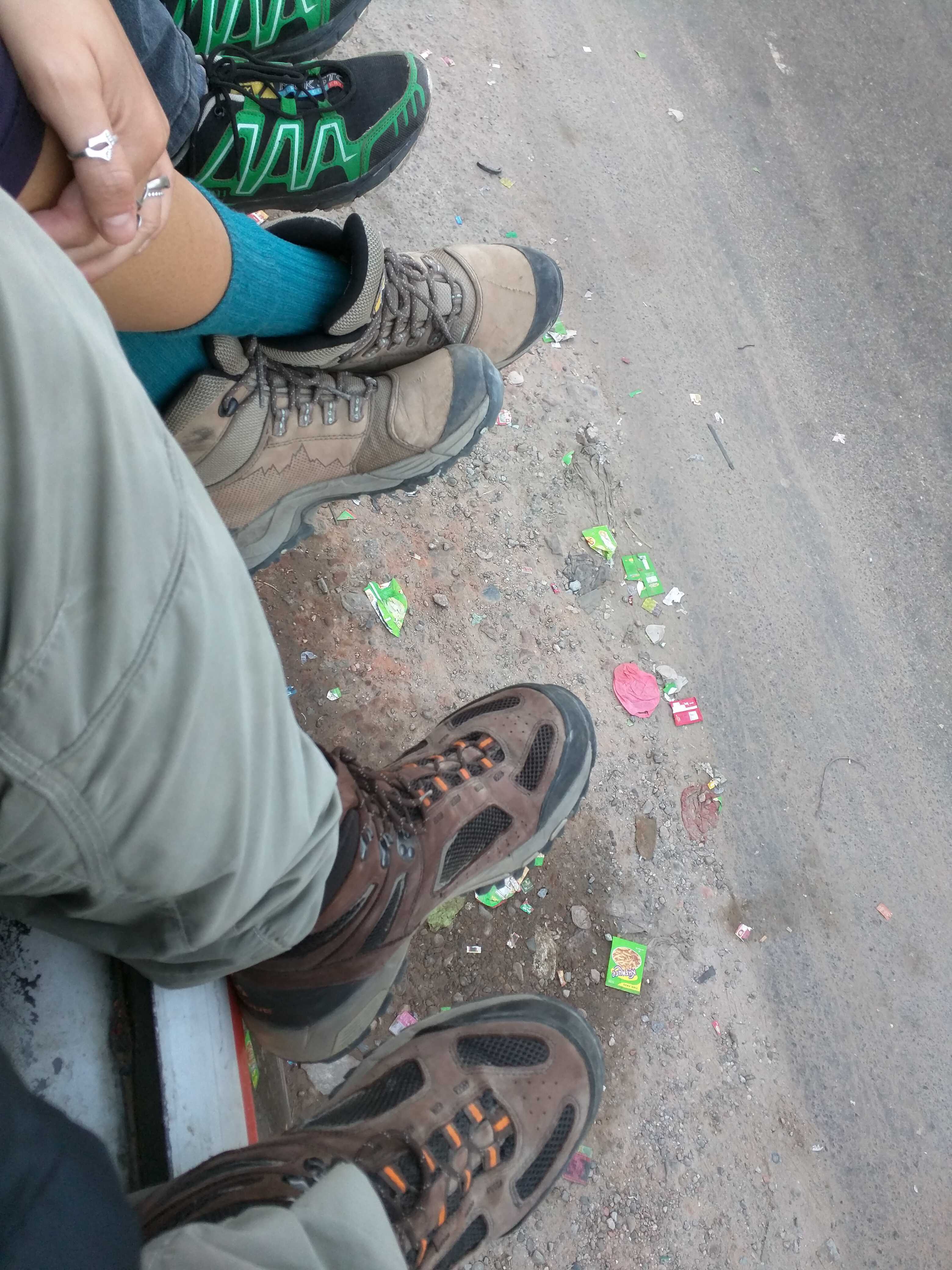
We were the only tourists on the roof! Normally, they don’t even let tourists on the roof, but due to the fuel crisis, there were so few buses running that we really didn’t have much of a choice (plus, we kind of wanted to experience riding on the roof… sorry, Ima, Aba, Mamma, Pappa…). Not gonna lie, it was so much fun! But also terrifying. The bus flew down windy mountain roads with the engine shut off to conserve fuel (again… fuel crisis), hugging tight curves, breaking and accelerating rapidly, while constantly taking on more and more people! Great experience, but we’re thankful to be alive 🙂